The approach and work packages of EMSAfrica
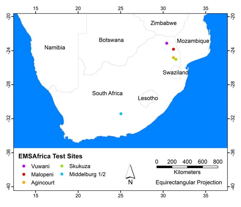
During the predecessor project ARS AfricaE (2014-2018), we established six observation sites in South Africa (see map below). These sites represent a climatic gradient and different land management types from peri-urban to grazed and protected, natural-like environments.
To disentangle the impacts of land management from the impacts of climate, the sites are “paired” so that the managed sites are located as close as possible to a similar site on a natural-like environment. This way, we can expect that observed differences between the sites are due to land use rather than climate.
Each of our work packages conducts different measurements on these sites. By working together and integrating our data, analyses and results, it is possible for us to build models on the Southern African vegetation patterns and carbon balance. Furthermore, our aim is to scale up this information into combined models that can be used to aid land-use decision making.
You can read about the work plan and aims of each of the work packages, including the cross-cutting interdisciplinary aims, by choosing a topic on the bottom of this page.
Middelburg 1 & 2: These are our driest observation sites, located at a short distance from each other at the semi-arid Eastern upper Karoo area. Average precipitation totals only 372 mm, with a rainy season during the hot summer, and a cold, dry winter. On our first site, controlled grazing is practiced, and the vegetation is a combination of shrubs and palatable grasses. Our second site shows the signs of past overgrazing, although it is currently rested from grazing: vegetation is characterized mainly by unpalatable grasses.
Skukuza: This site is located inside South Africa’s largest protected area, the Kruger National Park, and thus has minimum human impact. Skukuza is also semi-arid, with average annual rainfall of 547 mm. The Skukuza site is situated at a spot where a Combretum-dominated savanna changes into Acacia-savanna.
Agincourt: This site represents similar climate than Skukuza, but it is under a village settlement. The site is classified as savanna woodland. Malopeni: Similarly to Skukuza, this site is located inside the Kruger National Park. It is a savanna ecosystem with approximately 30% tree coverage.
Vuwani: This site is in a peri-urban setting, in a strongly human-impacted ecosystem. It is the most humid of our sites, and classified as a mesic savanna.